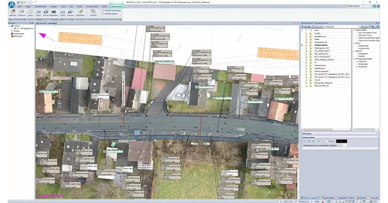
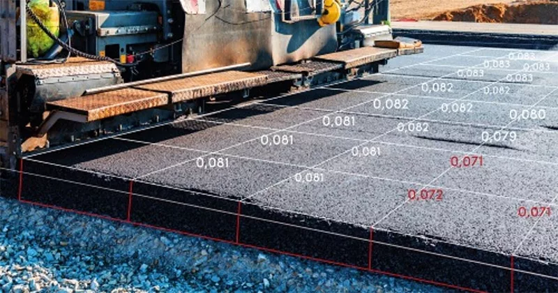
The use of state-of-the-art technology in construction surveying, machine control and daily cooperation with clients or partner companies requires clear standards for data preparation and data transfer.
Only in this way can you efficiently deal with the project or construction activity on site and not spend far too much of your working time on collecting, analyzing and evaluating model and process data.
From the Point Cloud to the Finished Plan - can also be done with 60% less effort in the field.
Measurement data are generally all data that you generate with measuring devices or receive from surveyors. In addition to general data from a total station survey, this increasingly includes point clouds, for example from laser scanning procedures or drone surveys. These point clouds usually contain large volumes of data, which you can process in a targeted manner with iTWO civil and efficiently obtain the necessary information for upcoming work processes.
iTWO civil allows a very flexible and individually configurable transfer of data from the surveying of stations such as Leica, Topcon, Trimble. On site, the surveying can be checked for completeness, characteristics and coding. In the office, you immediately have a usable result in the form of 3D objects. Through further object qualification, your survey results can easily be prepared for further BIM 5D process steps (tender, costs, quantities).
Today, point clouds are common sources of information for planning and calculation (in project phase 1). You process these purposefully with iTWO civil and extract only the information relevant for the next project step.
Performance features:
Pictures: Topcon Positioning Systems, Inc. - Microdrones
You need a drone survey, but do not have your own drone? passpunkt.de provides experienced drone specialists who work with the latest technology. You will receive a careful drone survey and data of the highest quality for transfer to iTWO civil.
Digitization requires continuous data exchange, also in the daily cooperation with clients or partner companies. With iTWO civil, you can communicate securely and without loss with virtually any system via standardized data exchange modules.
Data transfer from construction machines and data transfer to construction machines and surveying are possible via LandXML to Topcon, Trimble, MTS, Leica and others. Standard formats for drainage, construction machine control, point clouds, etc. - Additional aids such as georeferenced aerial photos from the state survey offices, laser scan data or PDF plans can be processed without any problems.
Pictures: Topcon Positioning Systems, Inc.
Overview CAD solution Civil Engineering
Overview Software solution for Plan Build Operate
Benefit from our expertise and your digital strategy will pick up speed!
Civil Engineering and Infrastructure Planning
Always the right contact for your specialist questions about our products.