


RIB Civil: Fachanwendungen und Module für Ihre Aufgaben im Straßen- und Tiefbau
RIB Civil
RIB Software bietet Ihnen Tools für die komplette Projektabfolge – von der Vermessung über die Straßen- und Entwässerungsplanung, die Geländemodellierung bis zu AVA, Abrechnung und BIM – aus einem Haus.
Mit RIB iTWO Civil bearbeiten Sie jedes Straßen- Kanal oder Erbauprojekt in jeder Phase schnell und sicher, durchgängig grafisch-interaktiv und richtlinienkonform.
Features und Funktionen
Datenmanagement Und -Sicherheit
– Integriertes Management für große Datenmengen (Punktwolken, Maschinendaten)
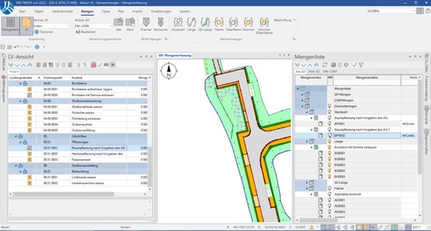
– Zusammenspiel aller Projektdaten – Grundriss, Querprofil, Trassenelemente – im direkten Zugriff
– Sofortige Visualisierung im Projekt, Intelligenter Fehlermanager, automatisierte Planaufbereitung
– Single Source of Truth: Ein Projektstand in allen Programmanwendungen

Klare Und Einfache Benutzerführung
– Minimierte Klickwege, einfache Bearbeitungsschritte, mächtige CAD-Funktionen
– Intelligente Benutzerführung durch leistungsstarken Folienmanager, Fehlermanager u.a.
– Für neue Mitarbeiter schnell und leicht zu erlernen
Integrierte Entwässerung Und Abrechnung
– Schnelle und nachvollziehbare Berechnung von Aushub, Verfüllung, verbauter Fläche
– Abrechnung von Grabenaushub über Tiefenstufen
– Berücksichtigung von DIN 1610, 4124, 18300
– 3D-Visualisierung
Datenaustausch Und Datenübernahme
– Unterstützung aller Standardschnittstellen (dxf/dwg, LandXML, OKSTRA, ALKIS, ISYBAU …)
– Web Map Services (WMS)
– Mehrsprachigkeit
Direkte Modell-Aufbereitung Für Rib Itwo Bim 6D
– Volumenkörper aus der Querprofil-Mengenberechnung
– Automatische Generierung von Attributen für alle Elemente
– Aufbereitung CPIXML-Daten mit durchgängiger Aktualisierung der Projektdaten inkl. Entwässerung